


| Tom Gonsiewski wrote: |
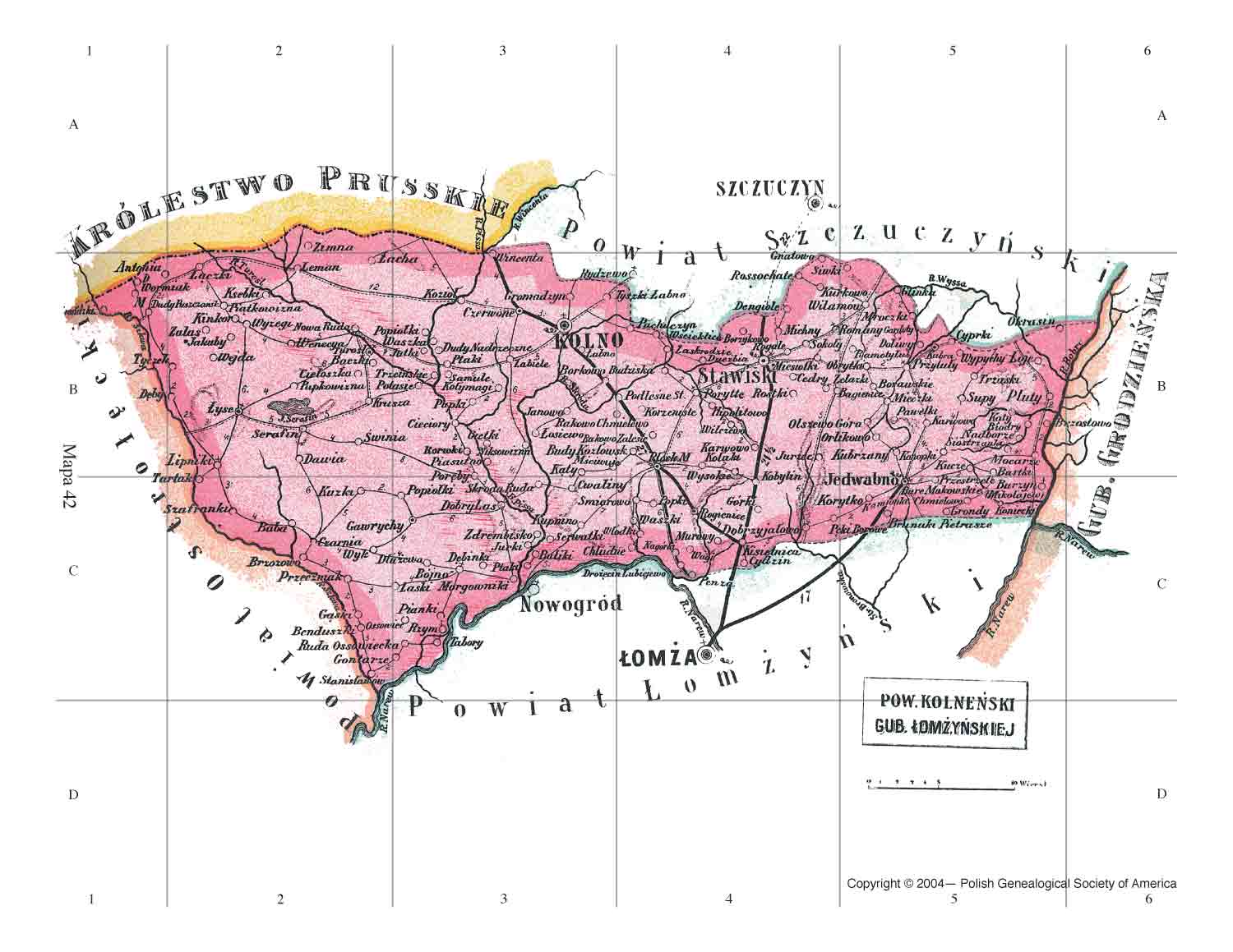
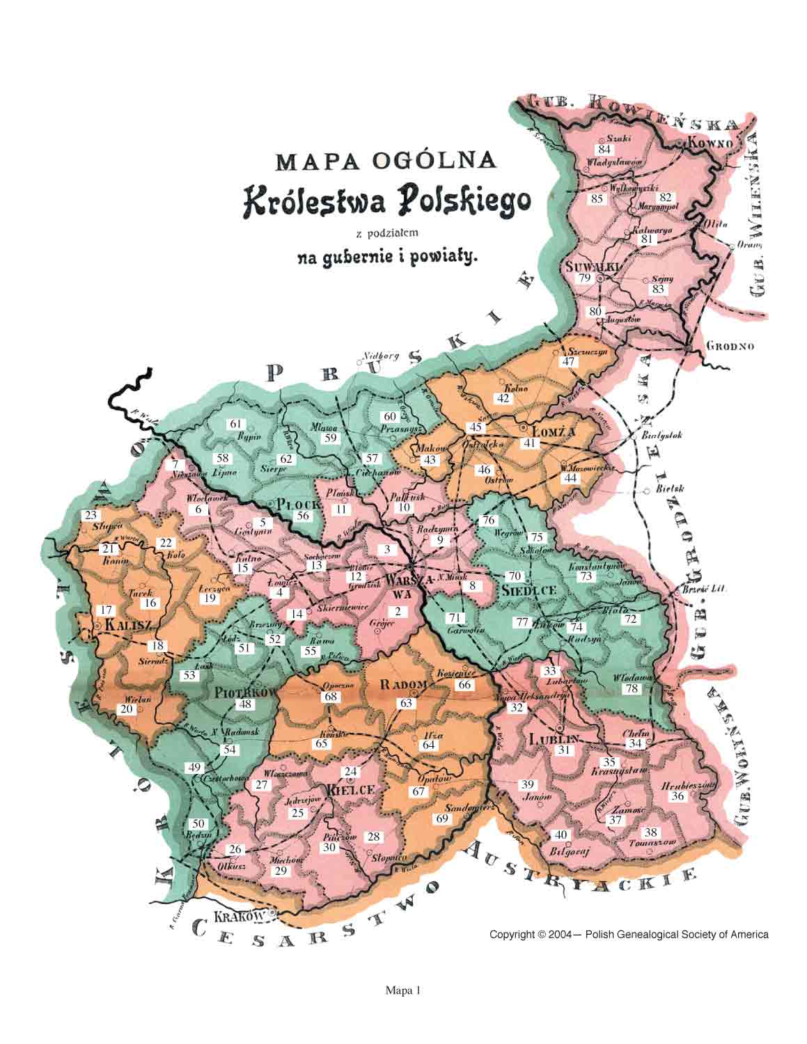
| I have a post already about my Grandfather, Peter Gonsiewski. He was born in 1878 in Ka~ty, Gmina Maly Plock.
Where can I find a map of that area from the time period 1878-1900? I would like to see there his town was in relation to all the divisions and partitions of Poland. Thank you. |
| 42.Kolnenski.jpg | ||
| Description: |
|
|
| Filesize: | 121.67 KB | |
| Viewed: | 0 Time(s) | |
 |
||
| 01.PowLoc.jpg | ||
| Description: |
|
|
| Filesize: | 125.38 KB | |
| Viewed: | 0 Time(s) | |
 |
||